Cities don’t need more data. They need the appropriate data, at the appropriate time, in the appropriate place. Enter IoT-based environmental monitoring. From tracking air quality at street level to predicting floods before they hit, cities are using sensor networks to make urban planning more precise, more responsive, and evidence based. This approach is also applied in oil and gas industry consulting to optimize operations and mitigate risks.
In this section, we talk about how to design this situation, where it already is, and how planning teams and solution providers can begin designing a smarter system from the ground up.
IoT-Based Environmental Monitoring: What Is It?
IoT-based environmental monitoring, utilizing networked sensors, is utilized to measure environmental phenomena in real time. While originally scoped to focus on larger urban systems such as urban economic development, construction, noise, or traffic, it can also document the condition of the urban environment (e.g., tracking temperature, noise, water, and air quality) simultaneously across a city. Similar sensor-driven approaches are increasingly valuable in oil and gas industry consulting to enhance safety, efficiency, and predictive maintenance.
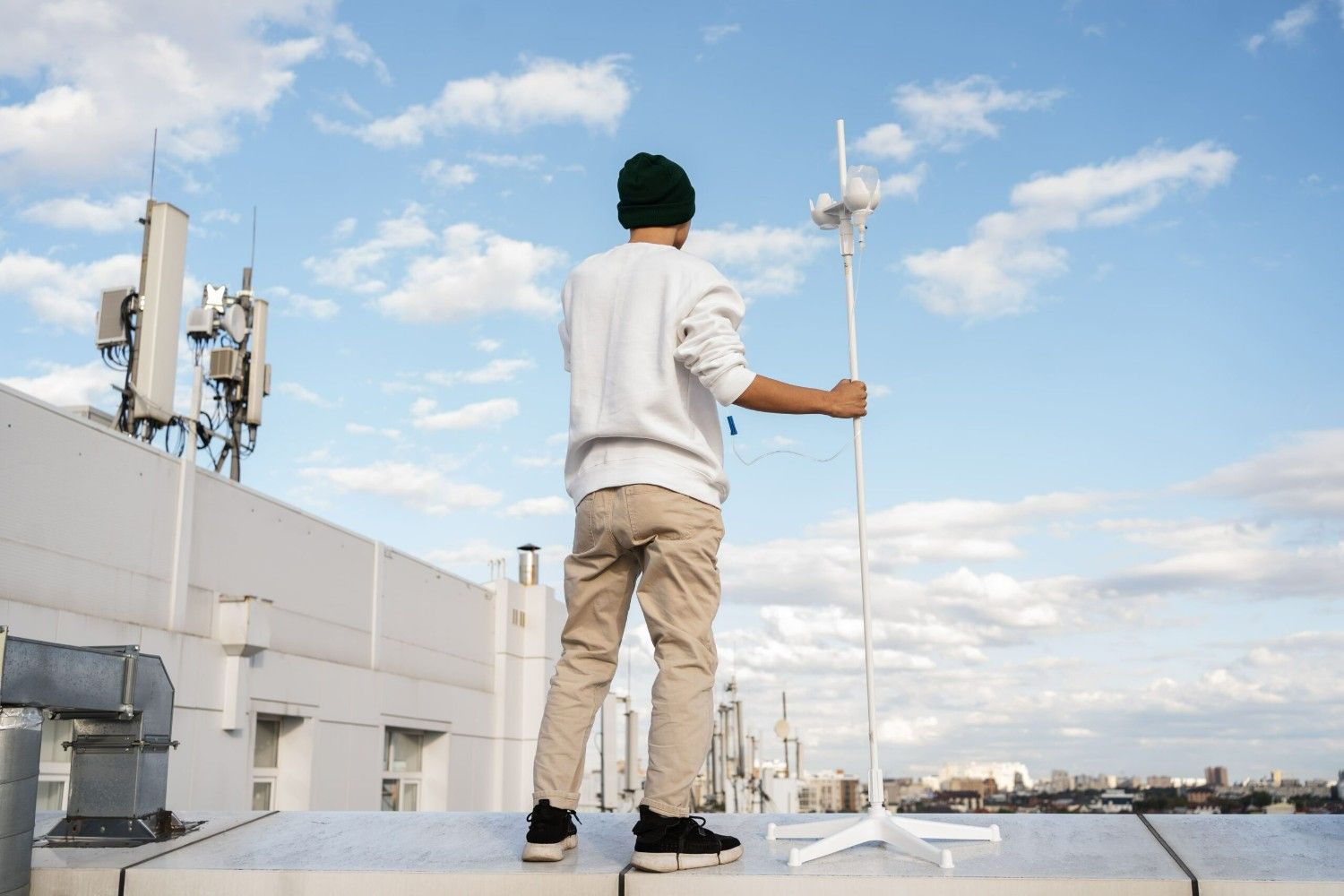
These sensors can be attached to steeples or buildings, visibility from vehicles, or new towers built specifically for dispersion of data collection, and their data continues to be collected continuously through the wireless networks to monitor real-time changes, such as pollution increases, temperature spikes, moisture increases, etc. They populate database(s) amassed in collected patterns, cleaned, processed, and available via dashboards from either a cloud service or edge processing resource.
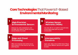
Key IoT Technologies Behind Smart Environmental Monitoring
Smart environmental monitoring is predicated on a highly integrated stack of hardware, connectivity, and processing technologies that have all been optimized to read and act on environmental data in real-time.
1. High-Precision Environmental Sensors
Sensors calibrated for urban deployments measure variables like PM2.5, NO₂, CO₂, temperature, humidity, and noise levels. Many are low-cost yet capable of research-grade accuracy when deployed and maintained correctly. They are compact, power-efficient, and suitable for long-term operation in varied weather conditions.
2. Wireless Sensor Networks (WSNs)
Data from these sensors travels via low-power, wide-area networks such as LoRa, DASH7, or NB-IoT. These protocols enable dense, city-wide coverage with minimal energy use, even in areas with weak connectivity infrastructure.
3. Edge and Cloud Processing
Edge devices conduct initial filtering and compression of data close to the point of origin to minimize loads for transmission. Data is processed and forwarded to cloud platforms for more thorough analysis, storage, and incorporation into planning teams’ or emergency response units’ dashboards.
4. Interoperability Standards
To manage data from multi-vendor sensors, standards such as OGC SensorThings API make various sensor types communicate in a common language. This enables scalable integration into larger urban data environments.
These core technologies work together to deliver continuous, reliable environmental insights, making them foundational tools for modern urban planning.
Real-World Use Cases: How Cities Are Using IoT to Monitor Environments
Cities from around India and indeed the world are already employing IoT-based solutions to address actual planning issues. What’s remarkable, however, is not the technology in itself, it’s how cities are leveraging it to measure better, react more quickly, and plan more cleverly.
The following are three areas where the effect is already evident:
1. Air Quality Mapping at Street Level
In Hyderabad, low-cost air quality sensors were installed in a network of 49 stations to continuously monitor PM2.5 and PM10 for months, including during seasonal peaks and festival seasons.
What made this deployment successful wasn’t so much the size, but the capacity to see hyperlocal pollution data that the traditional stations fail to capture. This enabled urban planning teams to detect street-level hotspots, inform zoning decisions, and tell public health messaging with facts, not guesses.
2. Flood Response Through Real-Time Water Monitoring
Gorakhpur installed more than 100 automated water-level sensors linked to an emergency control center. The IoT sensors assist urban teams in monitoring the levels of drainage, initiating pump operations, and acting on flood dangers within hours rather than days.
The payoff? 60% less pump downtime and a quantifiable reduction in water wastage response time. This data-driven infrastructure is now incorporated into the city’s larger flood preparedness plan, providing this time planners with real-time insight into areas of risk.
3. Urban Heat and Climate Insights for Planning
In Lucknow, IIIT has broadened its sensor-based observatory to cover environmental data other than temperature, including humidity, air pollution, and wind behavior. The objective is to construct early warning models, heat mapping, and sustainable land-use planning decisions.
For urban planning authorities, this type of layered environmental intelligence feeds into everything from tree-planting areas to heat-resilient infrastructure planning, particularly urgent as Indian cities continue to urbanize and heat up.
These examples demonstrate that IoT-based monitoring is not only generating raw data but also actionable knowledge. And, incorporating that knowledge into the planning process changes reactive management of our cities to proactive, evidence-based actions.
Benefits of IoT Environmental Monitoring for City Planning Teams
Environmental information only looks good on paper. For urban planning departments and the service providers who assist them, IoT-based monitoring systems provide more than sensor readings; they unlock clarity, efficiency, and control.
This is what that means in everyday decision-making:
- Catch problems early – Receive real-time notifications on pollution surges, water-level fluctuations, or noise areas, and teams can respond, not merely react.
- Plan with hyperlocal accuracy – Utilize hyperlocal data to plan infrastructure where it really matters, such as green buffers, noise barriers, or drainage improvement.
- Evidence-based, not assumption-based zoning and policy – Use measurable trends in the environment to support land-use decisions, not assumptions.
- Strengthen disaster preparedness – Feed real private sector and municipal data in real time to heat wave, flood, and air-quality alert systems to allow for early action.
- Improve collaboration between departments – Build a shared dashboard or live map for multiple civic teams, including garbage, roads, and transportation departments.
Getting Started with IoT in Urban Environmental Monitoring
Getting started does not mean executing an entire city system on day one. It is about having clarity about what and where to measure, and how to make that information useful quickly. Here is how to start from concept to reality.
1. Start with a clear problem
Before choosing sensors or platforms, identify what your city or client needs to monitor first:
- Is it the air quality near traffic hubs?
- Waterlogging in low-lying zones?
- Noise levels near commercial areas?
The more specific the problem, the sharper the system design.
2. Use low-cost, research-grade sensors for pilot zones
Don’t wait for a budget that covers 300 locations. Start with 10. Deploy compact, solar-powered, or low-energy sensors in targeted spots where monitoring gaps exist. Prioritize places with:
- Frequent citizen complaints
- Poor historical data
- Known high-risk zones
This gives you proof-of-use before scaling.
3. Connect through reliable, low-power networks
LoRa, NB-IoT, or DASH7 — choose the protocol based on:
- Signal coverage
- Data volume
- Energy constraints
What matters is stable, uninterrupted data flow, not theoretical bandwidth.
4. Don’t ignore the dashboard
A real-time sensor is only useful if someone can see what it’s telling them.
Build or adopt a dashboard that:
- Flags threshold breaches automatically
- Let’s teams filter by location, variable, or trend
- Can be shared across departments without tech training
If it needs a manual report to explain, it’s not useful enough.
5. Work toward standards from the beginning
You might start small, but plan for scale. Use data formats (like SensorThings API) that will integrate easily into larger city platforms later, without rewriting everything from scratch.
6. Involve planners
A planning team should know how to use the data before the system goes live. Hold working sessions between tech vendors and municipal engineers. Discuss what insights matter most and build your system around them, not the other way around.
Conclusion
Environmental challenges in cities aren’t getting simpler, but how we respond to them is. With IoT-based monitoring, urban planners and solution providers can shift from reactive cleanups to proactive decisions backed by real-time data. But technology alone doesn’t drive that shift. It takes tailored systems that fit local conditions, integrate with existing platforms, and evolve with the city’s needs. The role of artificial intelligence in agriculture shows a similar pattern, where data-driven insights and adaptive systems help address complex environmental and operational challenges.
SCS Tech partners with companies building these solutions, offering development support for smart monitoring platforms that are scalable, adaptive, and built for real-world environments.
If you’re exploring IoT for environmental planning, our team can help you get it right from day one.