Tag: #gis platform

  • What Happens When GIS Meets IoT: Real-Time Mapping for Smarter Cities

    What Happens When GIS Meets IoT: Real-Time Mapping for Smarter Cities

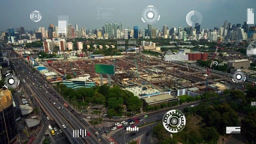
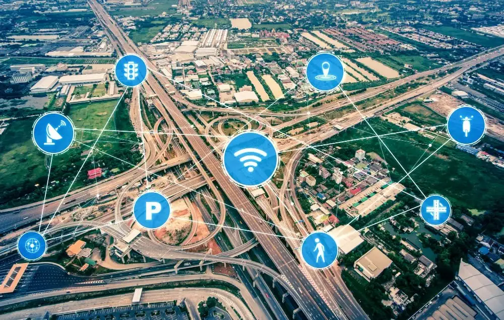
    Urban problems like traffic congestion and energy wastage are on the increase as cities get more connected. 

    While the Internet of Things (IoT) generates a great deal of data, it often lacks spatial awareness, so cities cannot respond in an effective manner. In practice, 74% of IoT projects are considered to fail, often due to issues like integration challenges, insufficient skills, and poorly defined business cases. 

    Including Geographic Information Systems (GIS) with IoT offers cities location-based real-time intelligence to make traffic, energy, and safety management decisions more informed. The integration of GIS with IoT is the key to transforming urban data into actionable intelligence that maximizes city operations.

    The Impact of IoT Without GIS Mapping: Why Spatial Context Matters

    In today’s intelligent cities, IoT devices are amassing enormous quantities of data regarding traffic, waste disposal, energy consumption, and others. Yet without the indispensable geographic context of GIS, such data can stay disconnected, rendering cities with siloed, uninterpretable data. 

    IoT data responds to the query of “what” is occurring, yet GIS responds to the all-important question of “where” it is occurring—and spatial awareness is fundamental for informed, timely decision-making.

    Challenges faced by cities without GIS mapping:

    • Limited Understanding of Data Location: IoT sensors can sense problems, such as an increase in traffic jams, but without GIS, one does not know where precisely the issue lies. Is it a concentrating bottleneck or a city-wide problem? Without geospatial context, deciding which routes to upgrade is a shot in the dark.
    • Inefficiency in Response Time: If the whereabouts of a problem are not known, it will take longer to respond to it. For example, waste collection vehicles can receive information about a full bin, but without GIS, it is not known which bin to service first. This can cause inefficiencies and delays.
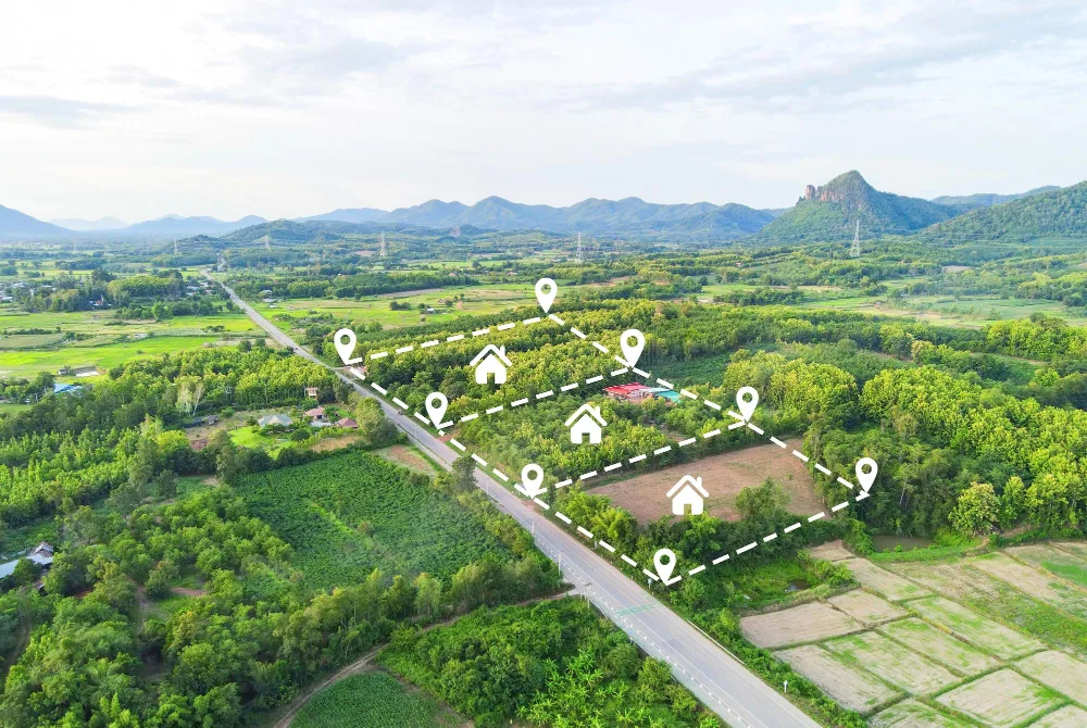
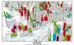
    • Difficult Pattern Discovery: It’s difficult for urban planners to determine patterns if data isn’t geographically based. For instance, crime areas within a neighborhood won’t reveal themselves until you put crime data on top of traffic flow maps, retail maps, or other IoT maps.
    • Blind Data: Context-less data is worthless. IoT sensors are tracking all sorts of metrics, but without GIS to organize and visualize that data on a geographic basis, it’s often overwhelming and worthless. Cities may be tracking millions of data points with no discernible plan about how to react to them.

    By integrating GIS with IoT, cities can shift from reactive to proactive management, ensuring that urban dynamics are continuously improved in real-time.

    How Real-Time GIS Mapping Enhances Urban Management

    Edge + GIS Mapping

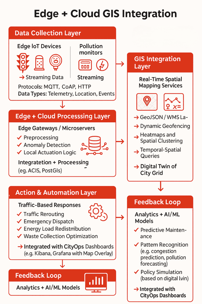
    IoT devices stream real-time telemetry—air quality levels, traffic flow, water usage—but without GIS, this data lacks geospatial context.

    GIS integrates these telemetry feeds into spatial data layers, enabling dynamic geofencing, hotspot detection, and live mapping directly on the city’s grid infrastructure. This allows city systems to trigger automated responses—such as rerouting traffic when congestion zones are detected via loop sensors, or dispatching waste trucks when fill-level sensors cross geofenced thresholds.

    Instead of sifting through unstructured sensor logs, operators get geospatial dashboards that localize problems instantly, speeding up intervention and reducing operational lag.

    That’s how GIS mapping services transform isolated IoT data points into a unified, location-aware command system for real-time, high-accuracy urban management.

    In detail, here’s how real-time GIS mapping improves urban management efficiency:

    1. Real-Time Decision Making

    With GIS, IoT data can be overlaid on a map, modern GIS mapping services enable cities to make on-the-fly decisions by integrating data streams directly into live, spatial dashboards, making responsiveness a built-in feature of urban operations. Whether it’s adjusting traffic signal timings based on congestion, dispatching emergency services during a crisis, or optimizing waste collection routes, real-time GIS mapping provides the spatial context necessary for precise, quick action.

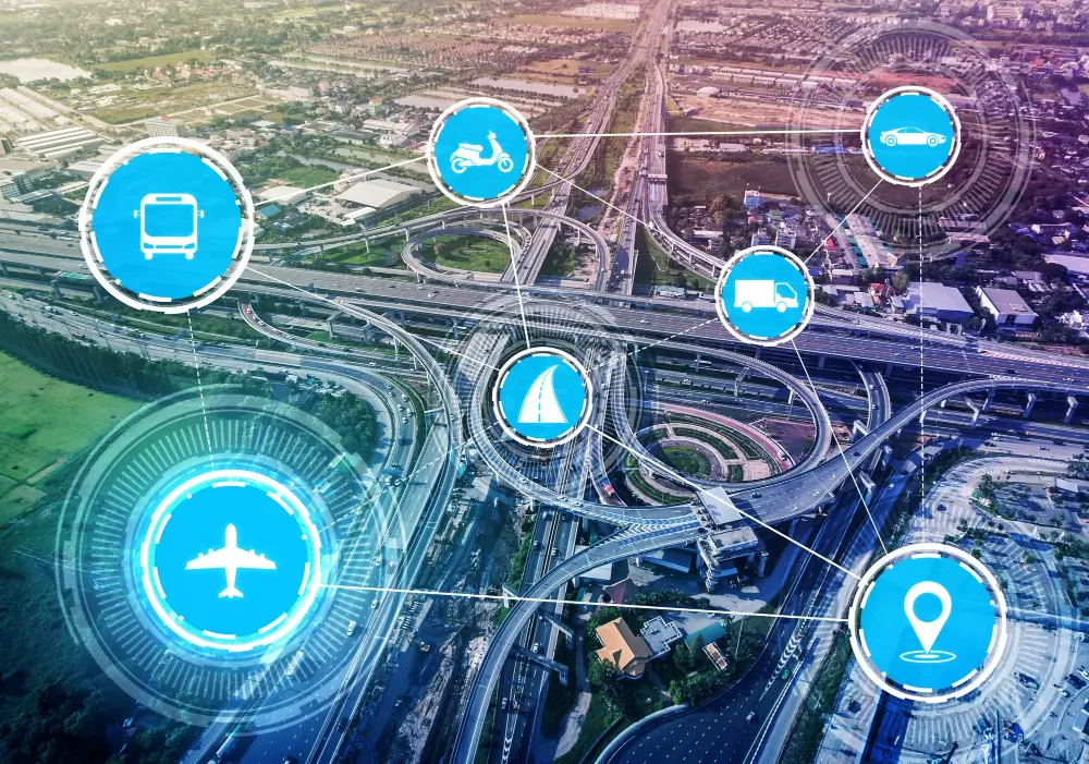
    • Traffic Management: Real-time traffic data from IoT sensors can be displayed on GIS maps, enabling dynamic route optimization and better flow management. City officials can adjust traffic lights or divert traffic in real time to minimize congestion.
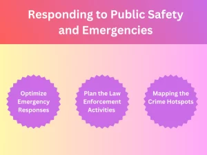
    • Emergency Response: GIS mapping enables emergency responders to access real-time data about traffic, weather conditions, and road closures, allowing them to make faster, more informed decisions.

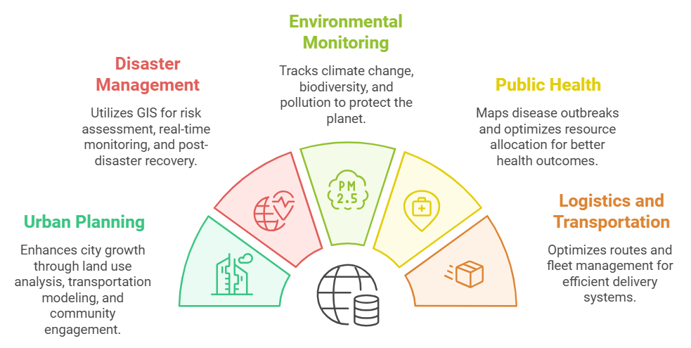
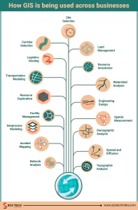
    2. Enhanced Urban Planning and Resource Optimization

    GIS allows cities to optimize infrastructure and resources by identifying trends and patterns over time. Urban planners can examine data in a spatial context, making it easier to plan for future growth, optimize energy consumption, and reduce costs.

    • Energy Management: GIS can track energy usage patterns across the city, allowing for more efficient allocation of resources. Cities can pinpoint high-energy-demand areas and develop strategies for energy conservation.
    • Waste Management: By combining IoT data on waste levels with GIS, cities can optimize waste collection routes and schedules, reducing costs and improving service efficiency.

    3. Improved Sustainability and Liveability

    Cities can use real-time GIS mapping to make informed decisions that promote sustainability and improve liveability. With a clear view of spatial patterns, cities can address challenges like air pollution, water management, and green space accessibility more effectively.

    • Air Quality Monitoring: With real-time data from IoT sensors, GIS can map pollution hotspots and allow city officials to take corrective actions, like deploying air purifiers or restricting traffic in affected areas.
    • Water Management: GIS can help manage water usage by mapping areas with high consumption or leakage, ensuring that water resources are used efficiently and wastefully high-demand areas are addressed.

    4. Data-Driven Policy Making

    Real-time GIS mapping provides city officials with a clear, data-backed picture of urban dynamics. By analyzing data in a geographic context, cities can create policies and strategies that are better aligned with the actual needs of their communities.

    • Urban Heat Islands: By mapping temperature data in real-time, cities can identify areas with higher temperatures. This enables them to take proactive steps, such as creating more green spaces or installing reflective materials, to cool down the environment.
    • Flood Risk Management: GIS can help cities predict flood risks by mapping elevation data, rainfall patterns, and drainage systems. When IoT sensors detect rising water levels, real-time GIS data can provide immediate insight into which areas are at risk, allowing for faster evacuation or mitigation actions.

    Advancements in GIS-IoT Integration: Powering Smarter Urban Decisions

    The integration of GIS and IoT isn’t just changing urban management—it’s redefining how cities function in real time. At the heart of this transformation lies a crucial capability: spatial intelligence. Rather than treating it as a standalone concept, think of it as the evolved skill set cities gain when GIS and IoT converge.

    Spatial intelligence empowers city systems to interpret massive volumes of geographically referenced data—on the fly. And with today’s advancements, that ability is more real-time, accurate, and actionable than ever before. As this shift continues, GIS companies in India are playing a critical role in enabling municipalities to implement smart city solutions at scale.

    What’s Fueling This Leap in Capability?

    Here’s how recent technological developments are enhancing the impact of real-time GIS in urban management:

    • 5G Connectivity: Ultra-low latency enables IoT sensors—from traffic signals to air quality monitors—to stream data instantly. This dramatically reduces the lag between problem detection and response.
    • Edge Computing: By processing data at or near the source (like a traffic node or waste disposal unit), cities avoid central server delays. This results in faster analysis and quicker decisions at the point of action.
    • Cloud-Enabled GIS Platforms: Cloud integration centralizes spatial data, enabling seamless, scalable access and collaboration across departments.
    • AI and Predictive Analytics in GIS: With machine learning layered into GIS, spatial patterns can be not only observed but predicted. For instance, analyzing pedestrian density can help adjust signal timings before congestion occurs.
    • Digital Twins of Urban Systems: Many cities are now creating real-time digital replicas of their physical infrastructure. These digital twins, powered by GIS-IoT data streams, allow planners to simulate changes before implementing them in the real world.

    Why These Advancements Matter Now

    Urban systems are more complex than ever—rising populations, environmental stress, and infrastructure strain demand faster, smarter decision-making. What once took weeks of reporting and data aggregation now happens in real time. Real-time GIS mapping isn’t just a helpful upgrade—it’s a necessary infrastructure for:

    • Preemptively identifying traffic bottlenecks before they paralyze a city.
    • Monitoring air quality by neighborhood and deploying mobile clean-air units.
    • Allocating energy dynamically based on real-time consumption patterns.

    Rather than being an isolated software tool, GIS is evolving into a live, decision-support system. It is an intelligent layer across the city’s digital and physical ecosystems.

    For businesses involved in urban infrastructure, SCS Tech provides advanced GIS mapping services that take full advantage of these cutting-edge technologies, ensuring smarter, more efficient urban management solutions.

    Conclusion

    Smart cities aren’t built on data alone—they’re built on context. IoT can tell you what’s happening, but without GIS, you won’t know where or why. That’s the gap real-time mapping fills.

    When cities integrate GIS with IoT, they stop reacting blindly and start solving problems with precision. Whether it’s managing congestion, cutting energy waste, or improving emergency response, GIS and IoT are indeed gamechangers.

    At SCS Tech, we help city planners and infrastructure teams make sense of complex data through real-time GIS solutions. If you’re ready to turn scattered data into smart decisions, we’re here to help.

  • How GIS Companies in India Use Satellites and Drones to Improve Land Records & Property Management?

    How GIS Companies in India Use Satellites and Drones to Improve Land Records & Property Management?

    India, occupying just 2.4% of the world’s entire land area, accommodates 18% of the world’s population, resulting in congested land resources, high-speed urbanization, and loss of productive land. For sustainable land management, reliable land records, effective land use planning, and better property management are essential.

    To meet the demand, Geographic Information System (GIS) companies use satellite technology and drones to establish precise, transparent, and current land records while facilitating effective property management. The latest technologies are revolutionizing land surveying, cadastral mapping, property valuation, and land administration, enhancing decision-making immensely.

    This in-depth blog discussion addresses all steps involved in how GIS companies in India utilize satellites and drones to improve land records and property management.

    How Satellite Technology is Used in Land Records & Property Management

    Satellite imagery is the foundation of contemporary land management, as it allows for exact documentation, analysis, and tracking of land lots over massive regions. In contrast to error-prone, time-consuming ground surveys, satellite-based land mapping provides high-scale, real-time, and highly accurate knowledge.

    how satellite technology aids land records management

    The principal benefits of employing satellites in land records management are:

    • Extensive Coverage: Satellites can simultaneously cover entire states or the whole nation, enabling mass-scale mapping.
    • Availability of Historical Data: Satellite images taken decades ago enable monitoring of land-use patterns over decades, facilitating settlement of disputes relating to ownership.
    • Accessibility from Remote Locations: No requirement for physical field visits; the authorities can evaluate land even from remote areas.

    1. Cadastral Mapping – Determining Accurate Property Boundaries

    Cadastral maps are the legal basis for property ownership. Traditionally, they were manually drafted, with the result that they contained errors, boundary overlap, and owner disputes. Employing satellite imaging, GIS companies in India can now:

    • Map land parcels digitally, depicting boundaries accurately.
    • Cross-check land titles by layering historical data over satellite-derived cadastral data.
    • Identify encroachments by matching old records against new high-resolution imagery.

    For example, a landowner asserting additional land outside their legal boundary can be easily located using satellite-based cadastral mapping, assisting local authorities in correcting such instances.

    2. Land Use and Land Cover Classification (LULC)

    Land use classification is essential for urban, conservation, and infrastructure planning. GIS companies in India examine satellite images to classify land, including:

    • Agricultural land
    • Forests and protected areas
    • Residential, commercial, and industrial areas
    • Water bodies and wetlands
    • Barren land

    Such a classification aids the government in regulating zoning laws, tracking illegal land conversions, and enforcing environmental rules.

    For instance, the illegal conversion of agricultural land into residential areas can be easily identified using satellite imagery, allowing regulatory agencies to act against unlawful real estate development simultaneously.

    3. Automated Change Detection – Tracking Illegal Construction & Encroachments

    One of the biggest challenges in land administration is the proliferation of illegal constructions and unauthorized encroachments. Satellite-based GIS systems offer automated change detection, wherein:

    • Regular satellite scans detect new structures that do not match approved plans.
    • Illegal mining, deforestation, or land encroachments are flagged in real-time.
    • Land conversion violations (e.g., illegally converting wetlands into commercial zones) are automatically reported to authorities.

    For example, a satellite monitoring system identified the unauthorized expansion of a residential colony into government land in Rajasthan, which prompted timely action and legal proceedings.

    4. Satellite-Based Property Taxation & Valuation

    Correct property valuation is critical for equitable taxation and the generation of revenues. Property valuation traditionally depended on physical surveys, but satellites have made it a streamlined process:

    • Location-based appraisal: Distance to highways, commercial centers, and infrastructure developments is included in the tax calculation.
    • Footprint building analysis: Machine learning-based satellite imaging calculates covered areas, avoiding tax evasion.
    • Market trend comparison: Satellite photos and property sale data enable the government to levy property taxes equitably.

    For example, the municipal government in Bangalore utilized satellite images to spot almost 30,000 properties that had not been appropriately reported in tax returns, and the property tax revenue went up.

    How Drone Technology is Applied to Land Surveys & Property Management

    While satellites give macro-level information, drones collect high-accuracy, real-time, and localized data. Drones are indispensable in regions where extreme precision is required, such as:

    • Urban land surveys with millimeter-level accuracy.
    • Land disputes demanding legally admissible cadastral records.
    • Surveying terrain in hilly, forested, or inaccessible areas.
    • Rural land mapping under government schemes such as SVAMITVA.

    1. Drone-Based Cadastral Mapping & Land Surveys

    Drones with LiDAR sensors, high-resolution cameras, and GPS technology undertake automated cadastral surveys, allowing:

    • Accurate land boundary mapping, dispelling disputes.
    • Faster surveying (weeks rather than months), cutting down administrative delays.
    • Low-cost operations compared to conventional surveying.

    For example, drones are being employed to map rural land digitally under the SVAMITVA Scheme, issuing official property titles to millions of landholders.

    2. 3D Modeling for Urban & Infrastructure Planning

    Drones produce precise 3D maps that offer:

    • Correct visualization of cityscapes for planning infrastructure projects.
    • Topography models that facilitate flood control and disaster management.
    • Better land valuation insights based on elevation, terrain, and proximity to amenities.

    For example, Mumbai’s urban planning department used drone-based 3D mapping to assess redevelopment projects, ensuring efficient use of land resources.

    3. AI-Powered Analysis of Drone Data

    Modern GIS software integrates Artificial Intelligence (AI) and Machine Learning (ML) to:

    • Detect unauthorized construction automatically.
    • Analyze terrain data for thoughtful city planning.
    • Classify land parcels for taxation and valuation purposes.

    For instance, a Hyderabad-based drone-based AI system identified illegal constructions and ensured compliance with urban planning regulations.

    Integration of GIS, Satellites & Drones into Land Information Systems

    Satellite and drone data are integrated into Intelligent Land Information Systems (ILIS) by GIS companies in India that encompass:

    A. System of Record (Digital Land Registry)

    • Geospatial database correlating land ownership, taxation, and legal titles.
    • Blockchain-based digital land records resistant to tampering.
    • Uninterrupted connectivity with legal and financial organizations.

    B. System of Insight (Automated Land Valuation & Analytics)

    • Artificial intelligence-based property valuation models based on geography, land topology, and urbanization.
    • Automated taxation ensures equitable revenue collection.

    C. System of Engagement (Public Access & Governance)

    • Internet-based GIS portals enable citizens to confirm property ownership electronically.
    • Live dashboards monitor land transactions, conflicts, and valuation patterns.

    Conclusion

    GIS, satellite imagery, and drones have transformed India’s land records and property management by making accurate mapping, real-time tracking, and valuation efficient. Satellites give high-level insights, while drones provide high-precision surveys, lowering conflicts and enhancing taxation.

    GIS companies in India like SCS Tech, with their high-end GIS strength, facilitate such data-based land administration, propelling India towards a transparent, efficient, and digitally integrated system of governance, guaranteeing equitable property rights, sustainable planning, and economic development.

  • How GIS Mapping Services Support Climate Change Analysis and Long-Term Weather Forecasting

    How GIS Mapping Services Support Climate Change Analysis and Long-Term Weather Forecasting

    What if you could foresee rising seas, vanishing forests, or sweltering cities years before they become headlines? The key to this foresight is GIS mapping services.

    Far from being just another tool, GIS serves as a compass for navigating the complexities of a warming planet, enabling scientists, policymakers, and industries to act with unprecedented clarity.

    In this blog, we will explore how GIS mapping services support climate change analysis and long-term weather forecasting, breaking down complex processes into simple, actionable insights.

    How GIS Mapping Services Support Climate Change Analysis

    Monitoring Environmental Changes

    GIS mapping is indispensable in monitoring shifts in the natural world, from rising temperatures to shrinking glaciers.

    Temperature Tracking

    GIS enables accurate tracking of temperature variations over time:

    • Spatial Analysis: Methods such as Kriging and Inverse Distance Weighting (IDW) transform weather station data into highly detailed temperature maps. These maps indicate anomalies, allowing scientists to pick up on unusual trends.
    • Time Series Analysis: By combining historical data, GIS allows for determining seasonal patterns and long-term warming trends. For example, NOAA uses GIS to show how temperatures have dramatically increased since the late 20th century.

    Deforestation Monitoring

    Through the absorption of carbon dioxide, forests play a critical role; GIS mapping services tracks the health of these forests in the following way:

    • Remote Sensing: Satellite images, as in the case of Landsat, use vegetation indices such as NDVI, in which those with healthy forests represent areas of no deforestation.
    • Detection Change Algorithms: GIS detects changes between image times and reports forest loss measurement. GIS maps indicate how agricultural activities lead to deforestation.

    Glacier and Ice Cap Analysis

    GIS is instrumental in studying glaciers and ice caps, which are critical indicators of climate change:

    • Glacial Retreat Monitoring: Comparing the satellite images for decades, GIS quantifies the retreat of Himalayan glaciers, affecting water supply to millions.
    • Ice Mass Balance Studies: Using the elevation models in conjunction with the satellite data, GIS computes the ice loss and its contribution to the rise in sea levels.

    Air Quality Assessment

    Climate change increases poor air quality, but it offers a solution through GIS.

    • Source Pollution Mapping: Emission data are combined with weather models to create a GIS mapping of city pollution hotspots.
    • Health Impact Studies: Using GIS, policymakers link air quality data with health records to pinpoint areas for interventions that can reach vulnerable communities.

    Risk Assessment and Disaster Response

    Climate change is on the increase with the frequency of natural disasters. Using GIS maps helps assess risk and improve preparedness.

    Flood Risk Mapping

    Flooding is a perilous threat, and GIS can predict and mitigate the impact:

    • Hydrological Modeling: GIS can identify flood-prone areas and guide land-use planning with rainfall data and elevation maps.
    • Vulnerability Assessments: GIS overlays population density with flood risk zones, prioritizing resources for the most at-risk communities.

    Disaster Recovery Planning

    GIS streamlines response efforts during and after extreme weather events:

    • Real-Time Data Integration: In hurricanes or floods, GIS integrates real-time data (e.g., social media updates) to help emergency responders.
    • Resource Allocation Mapping: Recovery efforts are optimized by mapping available resources like shelters and medical facilities against affected areas.

    Urban Heat Island Mitigation

    Urban areas often trap more heat, worsening health risks during hot weather:

    • Heat Mapping: GIS finds the urban heat island by analyzing the land surface temperatures. It then aids in identifying priority cooling areas for planting trees or reflective rooftops.
    • Policy Development: Based on GIS-based findings, cities are developing a plan to reduce the risk of heatwave attacks.

    Climate Change Mitigation Strategy

    GIS contributes significantly to generating environmentally friendly alternatives that mitigate climate change.

    Carbon Emission Reduction

    Through GIS data analysis, carbon emissions can be decreased as data-informed decision-making helps.

    • Emission Mapping: GIS identifies emission hotspots by visualizing sources of greenhouse gases, such as industrial sites or busy highways.
    • Targeted Solutions: Cities can use this data to implement public transportation upgrades or renewable energy projects in high-emission areas.

    Sustainable Resource Management

    GIS promotes eco-friendly practices by guiding resource management:

    • Renewable Energy Site Selection: GIS identifies ideal locations for solar farms or wind turbines by analyzing sunlight exposure and weather patterns.
    • Land Use Planning: GIS data integration ensures new developments do not go against economic growth without preserving the environment.

    How GIS Mapping Services Support Long-Term Weather Forecasting

    Accurate weather forecasts are essential for agriculture, disaster preparedness, and energy management. It is made possible with GIS mapping services.

    Data Collection and Integration

    GIS collects and integrates various datasets to improve forecasting:

    • Sources: Data from weather stations, satellites, and global climate models offer a holistic view of atmospheric conditions.
    • Integration Techniques: Techniques like Kalman filtering combine real-time observations with model predictions to improve accuracy.

    Forecasting Techniques

    • Numerical Weather Prediction (NWP): Mathematical models mimic the atmosphere’s behavior, given the current state. GIS displays these results, making interpreting temperature or rainfall patterns easy.
    • Ensemble Forecasting: Running multiple simulations with slightly different initial conditions, GIS offers probabilistic forecasts that help planners plan for various eventualities.

    Visualization and Scenario Analysis

    GIS brings weather data alive:

    • Thematic Maps: Shows patterns such as drought-prone areas or the amount of expected rain. This transforms complex data in a way that is easily understandable to stakeholders.
    • What-If Scenarios: Users can simulate different scenarios, including rising greenhouse levels, to begin planning adaptive strategies.

    Conclusion

    GIS mapping services are transforming how we understand and tackle climate change. Leading GIS consultants and GIS companies in Mumbai are helping provide scientists, policymakers, and communities with actionable insights—from tracking rising temperatures to mitigating urban heat islands. Their expertise in GIS plays a key role in long-term weather forecasting, ensuring better planning—whether it’s safeguarding crops or preparing for floods.

    With increasing climate challenges, GIS mapping services will remain at the forefront to guide efforts toward a sustainable and resilient future. For innovative and reliable GIS solutions, SCS Tech stands as the ideal partner, empowering organizations with cutting-edge technology to tackle climate change effectively.

  • Understanding Big Data in GIS Applications: How It Shapes Our World

    Understanding Big Data in GIS Applications: How It Shapes Our World

    What if we could predict traffic jams, track pollution spread, and optimize city planning—all in real-time? Significant data infusion into geographical information systems (GIS) and advanced GIS services has made all these possible. The geospatial data analytics market has been growing globally, valued at $88.3 billion since 2020. This growth shows how organizations are using big data in GIS applications to make smarter decision

    In this blog, let’s discuss how Big Data is revolutionizing GIS applications, from cloud-based platforms to drone mapping services in India, and how GIS and IoT solve real-world problems.

    What Is GIS and Why Big Data Matters?

    GIS is a tool that enables us to visualize, analyze, and interpret spatial data—that is, data associated with specific locations on Earth. Think of it as a map with multiple layers of information, showing everything from land use to population density. Paired with Big Data—massive datasets with variety and speed—GIS transforms into a powerhouse for understanding complex relationships.

    For instance:

    • Big Data from IoT Sensors: The sensors in smart cities monitor real-time air quality, traffic, and temperature and feed into GIS systems with updated knowledge.
    • Crowdsourced Data: Platforms like OpenStreetMap enable individuals to share local knowledge, which feeds into maps with detailed information and accuracy.

    How Big Data Empowers GIS Applications

    Big data in GIS applications transforming mapping
    Big data in GIS applications transforming mapping

    Big Data empowers GIS in ways that methods of the past could not. Here’s how:

    1. Urban Planning Made Smarter

    • Land Use Analysis: Satellite imagery coupled with socioeconomic data helps planners track changes in land use over time. This ensures cities grow sustainably.
    • Transportation Modeling: GPS data from vehicles helps optimize routes and reduce congestion. For example, public transport systems can change routes dynamically based on traffic patterns.
    • Community Engagement: Interactive maps allow citizens to visualize and comment on urban projects, fostering transparency.

    2. Disaster Management: Saving Lives

    • Risk Assessment: GIS analyzes weather patterns and historical data to pinpoint areas at risk of flooding or earthquakes.
    • Real-Time Monitoring: During disasters, data from IoT devices and social media feeds helps responders understand the situation instantly.
    • Post-Disaster Recovery: Aerial drone images provide clear visuals of affected areas, speeding up relief efforts.

    3. Environmental Monitoring: Protecting the Planet

    • Climate Studies: Long-term satellite data reveals how vegetation and glaciers change over time due to global warming.
    • Biodiversity Conservation: GIS maps endangered species’ habitats, helping identify critical areas that require conservation.
    • Pollution Tracking: Air quality sensors feed into GIS systems that track how pollution spreads throughout cities, helping policymakers take action.

    4. Public Health: Monitoring and Controlling Diseases

    • Outbreak Mapping: GIS helped to visualize the case patterns in the COVID-19 pandemic. It allowed authorities to focus their resources on high-risk areas.
    • Resource Allocation: Through GIS, hospitals and clinics analyze population density in the area to provide better services.

    5. Logistics and Transportation: Moving Smarter

    • Route Optimization: Companies like UPS apply GIS to analyze traffic and deliver packages faster.
    • Fleet Management: GPS-enabled trucks feed the GIS system with location data, thus enabling real-time tracking and efficient route planning.

    Cutting-edge technologies in GIS

    GIS is growing with exciting technologies that make it even more powerful:

    Cloud-Based GIS Platforms

    Cloud technology has revolutionized GIS, making it accessible and scalable:

    • Real-Time Data Processing: Platforms like Esri’s ArcGIS Online allow seamless spatial data sharing and processing.
    • Collaboration: Teams can work on the same map from anywhere, fostering innovation and efficiency.
    • Cost-Effectiveness: Cloud-based GIS eliminates the need for expensive hardware, making it ideal for organizations of all sizes.

    Drone Mapping Services in India

    India’s rapid adoption of drone technology is transforming GIS applications:

    • Precision Mapping: Drones take high-resolution images for infrastructure projects and agriculture.
    • Disaster Response: Drones provide critical aerial visuals to aid recovery after natural disasters.
    • Urban Planning: Cities like Bangalore use drone data to plan better transportation and housing.

    GIS and IoT Applications

    IoT devices, from weather stations to traffic sensors, feed GIS systems with valuable real-time data:

    • Smart Cities: Sensors monitor everything from electricity usage to water flow, making for more innovative and sustainable urban environments.
    • Agriculture: IoT-enabled sensors monitor soil moisture and crop health for farmers to optimize yields.
    • Environmental Monitoring: Networks of IoT devices measure air and water quality, feeding GIS with critical ecological data.

    Challenges in Integrating Big Data with GIS

    With all its benefits, big data in GIS applications is fraught with its challenges:

    • Data Quality: Inaccurate or out-of-date data can result in poor decisions. Validation is a continuous process.
    • Technical Expertise: Professionals must be trained in geospatial analysis and data science, which requires extensive training.
    • Privacy Issues: The use of personal location data raises ethical issues. Clear policies and transparency are critical to building public trust.

    Future Directions for Big Data in GIS

    The integration of emerging technologies will redefine GIS:

    • AI and Machine Learning: These technologies will further power predictive analytics in GIS, automating pattern recognition and forecasting.
    • Cloud-Based GIS Platforms: Cloud storage will make smaller organizations more accessible and collaborative.
    • Drone Mapping Services: Drones equipped with GIS technology will continue to provide high-resolution data for agriculture, urban planning, and disaster response in India.
    • GIS and IoT Applications: IoT networks expand the scope of real-time monitoring from innovative city management to wildlife conservation.

    Conclusion

    The intersection of big data in GIS applications has opened doors for new understanding and solutions to complex geographic problems. From improving urban planning to enhancing disaster response and protecting the environment, GIS in India is playing a vital role in shaping a more innovative and sustainable world.

    As cloud-based GIS platforms and drone mapping services in India continue to evolve, companies like SCS Tech play an important role in driving innovation and delivering robust solutions. By addressing challenges such as data quality and privacy, we can utilize the full potential of Big Data in GIS applications, creating solutions that truly make a difference.


  • How GIS Mapping Services Is Changing Transport Planning for Smarter Roads and Railways?

    How GIS Mapping Services Is Changing Transport Planning for Smarter Roads and Railways?

    Are you aware that rising traffic congestion isn’t just slowing down commutes—it’s shortening lives? A study by the Harvard School of Public Health highlights the severity of this issue, highlighting the urgent need for advanced traffic management solutions. One promising approach is  (Geographic Information Systems) GIS mapping services.

    It offers innovative ways to optimize transport networks. But how are GIS technologies changing road and railway transport planning? How are they making roads and railways smarter and more sustainable?

    Read on further to learn how GIS significantly utilises data management, route optimization, asset management, and safety. GIS consultants play a key role in implementing these technologies effectively across industries. Also, discover how AI technology companies, through AI and cloud technology, can make future infrastructure smarter and more resilient.

    How GIS is Revolutionizing Transport Planning for Smarter Roads and Railways?


    How GIS mapping services enhance transport planning for smart roads and railways?

    #1. Improving Data Management in Transport Planning

    GIS mapping services provide a channel through which spatial data is essential to understanding the transport system and its planning. It can also be handled and analyzed crucially. It helps planners capture the big picture by combining multiple data sources, revealing insights into traffic patterns, land use, population distribution, etc.

    • Data Aggregation: GIS aggregates different data sources, such as satellite imagery, demographic data, and real-time traffic data. High-resolution satellite images reveal land use and infrastructure conditions. Meanwhile, demographic information highlights areas that need better connectivity. Traffic data from sensors and GPS devices help planners identify peak times and congestion hotspots.
    • Spatial Analysis: Utilizing GIS, planners can execute spatial analyses on how healthy regions are connected and the impact of new infrastructure. For example, they can determine service areas for public transportation or simulate how a new road would modify the local traffic patterns. Thus, it is possible to have improved investments in infrastructure and service planning.

    Enhanced data management by GIS mapping services helps planners understand transport networks holistically. It ensures that resources are applied where they are needed most.

    #2. Optimization of Routes in Roads and Railways

    Route optimization is one of the most potent applications of GIS in transport planning, thus helping to determine the best routes for new roads or railways. It makes route design easier because it can analyze the terrain, land use, and environmental features to minimize costs, avoid sensitive areas, and meet safety standards.

    • Terrain Analysis: Digital elevation models (DEMs) with GIS help planners review elevations and slopes to determine the least-cost construction routes. The process could be done using software like ArcGIS based on DEMs to look for steep slopes. This helps in creating alignments of new roads to increase safety.
    • Land Use and Environmental Mapping: Land use type mapping along the potential routes helps planners avoid sensitive environmental areas and comply with zoning regulations. Such analysis is essential in the design of routes that meet ecological and regulatory standards.
    • Traffic Simulation: GIS assists in traffic flow simulation, helping planners anticipate congestion and design better interventions. Real-time data on traffic will allow planners to foresee areas of congestion. This enables them to make infrastructure design adjustments that help avoid bottlenecks for more accessible and smoother traffic.

    These route optimizations ensure roads and railways are created with efficiency, sustainability, and reduced long-term costs.

    #3. Efficient Asset Management for Transport Infrastructure

    GIS mapping services serve as a means for transport agencies to handle their assets correctly, thereby keeping the transport infrastructure safe and reliable. Using GIS tools, one can provide detailed maps of assets like roads, bridges, and railways and then track and maintain their conditions.

    • Inventory Mapping: GIS asset databases will provide information on each asset’s condition, age, and maintenance history. For instance, ArcGIS’s Asset Management Module allows transport planners to visualize asset conditions so they can plan and schedule maintenance optimally.
    • Maintenance Scheduling: GIS can provide a basis for prioritizing maintenance based on urgency by analyzing historical data on asset wear and tear. This directs resources to the most critical areas. This approach to asset management through GIS enhances the lifespan of infrastructure and boosts overall safety and reliability.

    Asset management using GIS minimizes unexpected repairs but also maximizes investments in infrastructure, creating safer and more resilient transport networks.

    #4. Safety Improvements through GIS Mapping Services

    Safety in transport planning is one of the primary considerations, and through GIS mapping services, safety improvements can be ensured. As such, mapping identifies risk areas and designs effective responses in emergencies.

    • Hazard Mapping: With the help of GIS, hazardous places can be identified, like accident-prone zones or areas that are prone to natural disasters such as flooding. Accidents and environmental risks may be analyzed through GIS for patterns, which will help planners implement targeted safety improvements, like better signposting or road designs.
    • Emergency Response Planning: Transport agencies can support emergency planning by mapping critical infrastructures, hospitals, and fire stations using GIS. With real-time GPS, GIS enables transport agencies to make ready evacuation routes with quick responses towards emergencies.

    Safety through GIS-driven safety measures can reduce the possibility of accidents and improve preparedness for emergencies. This is achieved by creating transport systems that better protect the infrastructure and the community.

    Technological Innovations Towards Enhancing GIS in Transport Planning

    With the emergence of AI and cloud-based GIS solutions, the applications of GIS in transport planning are rapidly expanding.

    • AI and Predictive Analytics: AI-based GIS uses historical and real-time data to identify the need for maintenance and optimize traffic flow. Predictive models help transport planners forecast future traffic patterns, making it easier to design adaptable infrastructure.

    For instance, AI can analyze traffic and accident data to adjust signal timings or suggest new infrastructure that improves safety and flow.

    • Remote Sensing with Drones and Satellites: Drones capture high-resolution images of transport corridors with cameras and sensors. Rapid data gathering enhances the efficiency of planning and monitoring of infrastructure.

    Satellite imagery gives a broader view of land-use changes, providing valuable insights for planners. This helps them track how the expansion of urban areas is affecting transport needs.

    • Cloud-Based GIS for Collaborations: ArcGIS platforms offer the space to facilitate collaboration between transport planning projects. This includes collaboration from government agencies, private firms, and community organizations.

    The resource provisioning through the cloud is easily scalable as it can share the data without hassle. It also increases accessibility and flexibility to the GIS solutions.

    The above innovations make robust mapping services from GIS, ensuring accuracy in data, ease of collaboration, and efficiency of resources. This approach accounts for the complexities of transport planning.

    Conclusion

    As we look toward the future, GIS mapping services are set to transform transport planning, crafting road and rail networks that aren’t just routes but smart, sustainable pathways connecting us all. By integrating diverse data, route optimization, and asset management making it the bedrock of transport network design. This foundation will support both modern needs and future growth.

    GIS will play an even more vital role in shaping efficient and resilient transport systems as AI and cloud technologies advance. GIS companies in India like SCS Tech are at the forefront of this technology, and cities worldwide use GIS to create connected, future-proof networks. These networks are designed to be safe and sustainable.

  • The Importance of GIS Mapping Services in Oil & Gas Exploration and Management

    The Importance of GIS Mapping Services in Oil & Gas Exploration and Management

    In the high-stakes world of oil and gas, every decision matters—especially when it comes to exploration and infrastructure management. But how do industry leaders make the right call on where to dig, how to optimize their operations, and minimize risk? The answer lies in harnessing the power of Geographic Information Systems (GIS).

    As the GIS controller market heads towards an estimated 780 million USD by 2032, with an impressive annual growth rate of 13% from 2024 to 2032, the reliance on this cutting-edge technology is growing exponentially. Partnering with a trusted GIS company in Mumbai can provide the strategic edge needed to leverage this technology effectively. GIS isn’t just a tool; it’s a strategic advantage that turns raw data into actionable insights, helping companies boost safety, reduce costs, and make smarter, faster decisions in real time.

    GIS mapping services help them make smarter choices, increase safety, and save money by giving them highly detailed, real-time data about their operational environment. Read on for a look at how GIS boosts oil and gas exploration and management and how GIS companies in India are meeting the needs of the industry. To better understand how GIS achieves this, let’s explore its core functionalities in oil and gas exploration.

    GIS Data Integration and Visualization in Oil & Gas Exploration

    Data Integration

    GIS integrates different information types, which come from satellites and GPS data, as well as surveys on the geology of the subsurface and environmental reports. Because of this ability to integrate data types, companies can now get a better view of the big picture.

    In the operation of oil and gas exploration, among other information, GIS can consolidate knowledge of terrain, climatic conditions, and subsurface geology. With all this data on one map, companies can be better positioned to decide where to explore, where to drill, and get a better handle on their asset management.

    Data Layering

    Another essential feature of GIS is its ability to layer different types of data on a single map. For instance, oil and gas professionals can view geological, environmental, and infrastructural data together, helping them assess how landscapes, sensitive environments, and operational challenges might impact drilling decisions. This multi-layered approach simplifies complex analysis, improving planning and decision-making.

    Advanced GIS Tools in Oil & Gas Exploration

    LiDAR and Photogrammetry

    While GIS is the core platform for data visualization and analysis, it often works in tandem with tools like LiDAR (Light Detection and Ranging) and photogrammetry, which provide detailed 2D and 3D images of the terrain. These high-technology tools generate dense data sets that can be overlaid onto GIS systems for further analysis.

    For example, LiDAR is critical in oil and gas exploration because it helps assess the stability of the land, identifying safe drilling and pipeline routes while minimizing risks associated with unstable terrain. By integrating this data into GIS, companies can make more accurate decisions on where to drill or lay pipelines.

    Real-Time Data Processing

    GIS, when integrated with real-time monitoring systems such as SCADA (Supervisory Control and Data Acquisition) and IoT devices, allows companies to visualize real-time data. While GIS is not responsible for collecting this data, it plays a crucial role in analyzing and visualizing it.

    Real-time monitoring enables companies to track their assets, including pipelines and wells, and respond quickly to any potential issues, such as leaks or environmental hazards. GIS serves as the front-end interface, where teams can visualize real-time conditions and act swiftly to prevent costly damages or disasters.

    GIS Applications in Oil & Gas Exploration and Asset Management

    Exploration Optimization

    The exploration of oil and gas tends to be both expensive and risky. Companies can mitigate these risks using GIS mapping services, which provide information on the most optimal locations to drill based on data. GIS integrates seismic data, historical exploration records, and geological information to help determine sites that may have high-potential oil and gas reserves. This helps minimize drilling into unproductive areas. Therefore, losses in terms of time and money are minimal.

    Pipeline Management

    One of the most critical challenges in the oil and gas industry is managing pipelines, especially when they traverse rugged or environmentally sensitive terrain. GIS helps by analyzing land conditions, environmental risks, and potential obstacles, ensuring the safest and most cost-effective pipeline routes.

    Moreover, by integrating real-time data from monitoring systems, GIS can track the condition of pipelines and issue alerts when there is a risk of leakage or damage. This proactive management ensures that companies can address issues before they become significant problems, reducing the likelihood of environmental disasters and costly repairs.

    Environmental Impact Assessments

    Environmental considerations are of paramount importance in oil and gas operations. GIS is an invaluable tool for conducting Environmental Impact Assessments; it shows how operations may impact ecosystems in the near vicinity. Companies may overlay environmental data with operational maps to ensure that projects conform to ecological standards while minimizing adverse impacts on the surrounding area.

    Benefits of GIS in Oil & Gas Exploration and Management

    More Informed Decisions

    GIS lets oil and gas companies map out all their critical data in one place, making more intelligent and faster decisions during the asset life cycle’s exploration, development, and operations phases. Companies can then see detailed maps with information regarding geological risks and possible environmental impacts. This will thus decide whether a specific location is suitable to drill in turn saving money.

    Cost Savings

    Improving processes and increasing efficiency yields enormous savings for a company using GIS mapping services. Choosing a drilling location can save a lot of time and money since the loss of time and money through a non-productive site is avoided. More pipeline routing efficiency and current monitoring reduce more expensive repair work and avoid more downtime time. Operational expenses will be reduced.

    Cost Savings from GIS in Oil & Gas Operations

    Improved Safety

    Monitoring in real-time of hazards to safety and the environment of the oil and gas industry is essential. Even though GIS does not monitor equipment leaks or failure directly, it allows the companies to visualize and analyze data collected in real-time from other systems such as SCADA or IoT devices. In incidences, this system detects the problems, and by getting GIS images on display, the team can respond faster and stop further damage. This swift action does not only protect the workers but also helps avoid environmental disasters.

    The Future of GIS Mapping Services in Oil & Gas Industry

    The applications of GIS mapping services in oil and gas industries will have a promising future.

    • AI and Machine Learning Integration: Further AI and machine learning integration with GIS mapping services will likely spread its influence further. These technologies enable fast analysis of data and hidden patterns to help companies optimize drilling, predict equipment failures, and gain better operational efficiency.
    • Mobile GIS Applications: Mobile GIS applications are now becoming an essential aspect of field operations when mobile GIS can afford to reach far-flung areas. Realtime collection of data with instantaneous updating helps companies decide faster, communicate better, and reduce delays associated with oil and gas work activities.

    Key Takeaways

    GIS mapping services are changing the game in the oil and gas industry, where industries can make better decisions, reduce some of the costs, and become safer. GIS integrates various data, such as satellites and real-time sensor data, enabling compelling exploration, asset management, and regulatory compliance.

    GIS companies in India, such as SCS Tech India Pvt Ltd, are leading providers of GIS mapping services, which are increasingly vital to the oil and gas industry. We distinctively integrate advanced technologies with GIS applications, enhancing data accuracy and predictive capabilities for exploration, pipeline management, and environmental monitoring. Our solutions ensure precise, real-time mapping and analysis, optimizing efficiency and safety in high-risk and complex environments.

  • What to Look for When Choosing a GIS Mapping Service Provider

    What to Look for When Choosing a GIS Mapping Service Provider

    The GIS market is on track to hit $14.5 billion by 2025, fueled by its growing impact across sectors like transportation, space exploration, automotive design, and smart city planning. With such explosive growth, GIS is quickly becoming indispensable for industries looking to innovate and lead.

    This growth reflects that enterprises are now increasingly relying on GIS mapping services to enhance predictive modeling, optimize operations, and support strategic decision-making. As the demand for GIS solutions rises, selecting the right service provider becomes a critical focus on GIS mapping services that can offer precise geographic data to boost predictive modeling capabilities, optimize operations, and improve decision-making processes.

    Companies are focusing on GIS mapping service providers who not only offer robust systems that analyze, integrate, and display spatial or geographical data but also give tailored-based services as per the project demand to achieve business objectives. In this blog, we will focus on key factors that one should look for before selecting a GIS mapping services provider.

    Key Factors To Consider While Choosing A GIS Mapping Service Provider

    #1 Technical Expertise and Level of Qualification

    Delivering high-end GIS mapping services depends on skilled professionals who can efficiently handle GIS tools and technologies like big data handling, AI-driven geospatial analytics, etc., along with specialized projects like advanced spatial modeling. It is important to check that the service provider has a certification like GIS Professional (GISP).

    #2 Data Quality and Accuracy

    The data quality and accuracy are integral parts of GIS mapping as they impact the insights derived from spatial analysis. Poor-quality data can lead to increased GIS project costs and incorrect analysis, which can lead to wrong decisions.

    The following factors can be checked:

    • Check that the provider uses authoritative data sources and has a robust validation process, thereby maintaining quality and accuracy.
    • Look for providers offering in-depth metadata with information regarding data source, accuracy level, collection data, etc. to assess reliability.
    • Check whether the service provider is adhering to standards related to data accuracy set by various ISO or related bodies.
    • With a dynamic technological landscape, check that the provider is offering advanced data collection tools for better quality, like LiDAR, UAVs (Unmanned Aerial Vehicles), etc.

    #3 Service Offerings

    While choosing a GIS mapping service provider, it is important to explore what specialized and end-to-end services are offered and how they are aligned with your goal and can help you improve results. The key services offered by a GIS provider one can look for are given below:

    • End-to-end services, from the gathering of data to its processing, mapping, and final reporting for efficient project workflow, are the core services to be offered by GIS mapping service providers.
    • The service provider should offer integration of GIS data with other systems, such as CRM or ERP systems, for better utilization of data in enterprise operations.
    • Evaluate whether specialized services, like 3D modeling and visualization, are offered, mainly for urban planning/development and infrastructure-related projects. For projects involving customer mapping or asset management, the service provided should be able to provide geocoding and address matching.

    #4 Customer Service And Training

    The GIS mapping service provider should be able to offer the required customer service and training so that better utilization of GIS tools can be done to achieve the desired project outcomes. The key parameters to be looked at under the customer service and training component are

    • 24/7 Customer Support Service
    • Fast Response to Reduce Downtime
    • Comprehensive training programs, including workshops, webinars, etc.
    • Industry- or project-specific training
    • Training materials such as user manuals or video tutorials.
    • Effective feedback mechanism

    #5 Cost Structure

    While choosing a GIS mapping service provider, it is important to understand the different pricing models and how they align with your project and financial budget. In the chart below, different pricing models with key features and the right project alignment are mentioned.

    GIS Mapping services pricing model

    Other than the pricing models, cost transparency should be maintained by the service provider by highlighting the upfront fees and hidden costs like advanced customer support, data storage requirements, etc., so the organization can effectively manage contingency expenses.

    #6 Emerging Trends And Innovation Integration

    Staying updated with recent trends and innovations in GIS mapping that can be implemented in your enterprise and selecting the service provider as per the requirement is crucial for informed decision-making.

    Some of the latest innovations on the market are:

    • Real-time analytics
    • 3D GIS for better spatial visualization
    • Improved predictive analytics through machine learning and AI
    • Cloud-based GIS solution for scalability, better accessibility for remote teams, and flexibility
    • Geospatial Data Fusion to create comprehensive geospatial datasets by combining data from social media, satellites, and other sources.

    Conclusion

    The selection of the right GIS mapping service provider can be complex when you want to integrate specific requirements and advanced technologies.

    Evaluating the right GIS mapping service provider involves various factors, from technical qualification, customization, and integration to scalable solutions, as these factors help in making informed decisions that enhance an organization’s ability to leverage spatial information effectively.

    To ease out the process, consult experts from SCS Tech India to navigate the complexities and implement innovative approaches to optimize your spatial data management and have a competitive edge in the market by leveraging GIS technologies for your projects.

    FAQs

    1. What is the role of customer service when selecting a GIS mapping service provider?
      Customer service plays an important role when selecting a GIS mapping service provider for various factors like addressing issues promptly, offering required training, assisting in technical changes, and more to enhance the overall experience.
    2. What costs are involved in GIS mapping services?
      GIS mapping services include costs such as initial setup costs, software licenses, purchasing data, customizing the system, and fees involved in continuing support and maintenance.
    3. Are there any latest trends I should look after before choosing GIS mapping services?
      Yes, the current trends in GIS mapping services one should be aware of are real-time data processing, integration of machine learning for data analysis, 3D and VR mapping technologies, edge computing, and more.
    4. What are the core components of GIS mapping?
      The core components of GIS mapping include spatial data, hardware, GIS software, and database management. (more…)
  • The Role of GIS Companies in Smart City Initiatives

    The Role of GIS Companies in Smart City Initiatives

    With over 55% of the world’s population now living in urban areas, the success and sustainability of these regions depend heavily on how well cities can manage their resources and address contingencies. GIS technology provides the backbone for these efforts, offering comprehensive solutions for urban planning, infrastructure management, environmental monitoring, and public safety. 

    Geographical Information Systems (GIS) technology is a cornerstone of modern urban development and management. GIS companies in India leverage this sophisticated technology to undertake a wide array of critical tasks—from designing and planning new urban spaces to the redevelopment of heritage cities. 

    In this blog, we discuss the multifaceted roles of GIS companies in India, emphasizing their contributions to smart city development and the extensive benefits they offer to urban environments. From economic growth and business support to transportation management and disaster response, GIS technology is revolutionizing how cities operate and thrive in an increasingly complex world.

    Significance of GIS Companies in the Smart City Framework

    Both small and large GIS companies in India offer essential tools and services for smart city development. Smaller firms might focus on specific tasks like traffic management, while larger organizations provide a comprehensive range of services from a central hub. 

    The Geographical information system software technology enables the use of locational data to make informed decisions, significantly contributing to smart city initiatives.

    Supporting Local Businesses

    GIS technology assists local businesses in maintaining visibility to potential customers, thereby boosting the economic prosperity of cities. When combined with public utility, topographic, environmental, and demographic data, GIS becomes a powerful tool for various industries. 

    Image Source:

    Applications like Google Maps exemplify how GIS can update information on demographics, public utilities, networks, roads, and local businesses, aiding decision-making processes.

    Environmental Sustainability and Monitoring

    Smart cities strive to be environmentally sustainable, and GIS companies play a crucial role in this by providing environmental monitoring services. The different methods to predict natural disasters used by GIS companies are as follows: 

    • Managing natural resources
    • Tracking changes in green areas
    • Mapping pollution levels

    Additionally, GIS aids in planning water conservation, waste management, and renewable energy projects, fostering healthier urban environments.

    Tracking the Water Sources

    A city’s underground and overground water sources are known as the lifeline of its people. Instead of utilizing the invasive process, the GIS companies in India use remote sensors to track down the water flow in the city. This helps identify whether or not a drought or impending flood occurs because of construction work.

    Response to Emergencies and Public Safety

    GIS-based tools enhance public safety and emergency response capabilities by integrating spatial data with incident management systems. GIS companies enable authorities to: 

    • Optimizing the emergency responses
    • Planning out the law enforcement-related activities
    • Mapping all the crime hotspots

    If there is a natural disaster, the GIS companies in India will use the incident command system in disaster management to coordinate rescue efforts, resource allocation, and damage assessment. This will lead to an efficient and instant response, aid recovery, and reduce loss.

    Economic Developments

    Through a detailed spatial analysis, companies can use GIS technology to find the best opportunities for economic development. Cities can pull in businesses by displaying their market potential, demographic trends, and real estate.

    GIS will also help in supporting tourism as it can point out all the amenities and attractions in a city, which will contribute towards economic growth.

    Transportation and Traffic

    For all the smart cities, managing traffic is highly essential. GIS companies can use the GIS system to analyze traffic patterns, manage public transportation systems, and optimize routes.

    These companies will also be able to integrate the GIS devices into the GIS platforms to deliver live updates on the traffic. This will enhance mobility and alleviate congestion.

    Urban Development and Planning

    Image Source:

    With the help of GIS technology, companies can help with the interpretation of spatial data, analysis, and visualization. All these things are compulsory for urban planning.

    Many planners utilize this particular technology to map the present infrastructure, model upcoming developments, and assess land usage.

    By doing so, planners can make correct decisions on environmental management, public-related services, and zoning the transportation networks.

    Understanding the Benefits of GIS Technology

    The GIS technology is equipped with countless advantages, and the table below will give you detailed information on them.

    GIS Technology Benefits The Description
    Disaster Management Emergency planning and risk assessment can improve response and preparedness during natural disasters.
    Market Analysis  Analysis of spatial data and demographics will help support the marketing approaches and business locations.
    Visualization Offering a visual representation with maps can improve communication and understanding. 
    Agriculture Provides support for crop management and accurate farming and helps monitor all agricultural activities.
    Education Helps in offering various tools for teaching environmental science, geography and many other fields.
    Crime Mapping Aids in analyzing all the crime patterns to improve public safety and law enforcement.
    Utility Management Helps in managing the infrastructure with numerous utilities like gas, electricity and water.
    Historical Preservation Enables the management and preservation of all the cultural heritages and historical locations. 

    Final Thoughts

    The GIS companies in India play a completely multifaceted part In the smart city industries. The GIS-based devices and tools that they have in store are compulsory for creating livable, sustainable, and efficient cities. This will make the GIS companies indispensable partners in the smart city environment. 

    Furthermore, at SCS Tech India PVT Ltd, we offer GIS-based solutions and services across the globe. Leveraging avant-garde technology, our offerings include enterprise solutions, cloud computing, eGoverance, blockchain solutions, IT infrastructure, digital transformation, and utility and energy solutions. 

    Our innovative services and solutions establish a robust digital foundation in today’s transformed world. Take advantage of our services across diverse sectors, including agriculture, education, finance, and healthcare. Get in touch with us to learn more!

  • The Role of GIS in Natural Disaster Management

    The Role of GIS in Natural Disaster Management

    For business owners, preparing for natural disasters is paramount to safeguarding their operations and employees. That’s where Geographic Information Systems (GIS) come into play.

    In this blog, we’ll explore how geographical information system software, especially the solutions offered by companies in India, plays a vital role in disaster management. It provides invaluable support, from predicting where disasters might strike to guiding emergency responses.

    Join us as we uncover how GIS can empower businesses to protect their assets and ensure continuity during natural calamities.

    Understanding GIS and Its Applications in Natural Disaster Management

    Natural disasters can have devastating effects on communities and businesses alike. However, geographical information system software offers a powerful tool set to help mitigate these risks and manage the aftermath more effectively.

    What is GIS?

    At its core, GIS is a technology that captures, analyzes, and presents spatial or geographical data. This includes information such as maps, satellite imagery, and geographic coordinates.

    Applications in Disaster Management

    GIS plays a crucial role in various stages of disaster management:

    1. Prevention and Preparedness: Geographical information system software helps authorities identify risks and develop mitigation strategies by mapping potential hazards, vulnerable areas, and critical infrastructure. For example, it can be used to map flood zones, earthquake fault lines, and areas prone to wildfires.
    2. Response and Relief: it enables real-time monitoring and coordination of response efforts during a disaster. Emergency responders can use GIS to track the movement of a hurricane, identify affected areas, and deploy resources where needed most. GIS also helps establish temporary shelters, evacuation routes, and medical facilities.
    3. Recovery and Reconstruction: After the disaster has passed, it plays a vital role in assessing damages and planning reconstruction efforts. By mapping out the extent of destruction, it helps prioritize areas for recovery and allocate resources effectively. Additionally, it aids in monitoring environmental impacts, such as soil erosion or pollution, and planning restoration projects.

    GIS Methods to Predict Natural Disasters

    GIS technology is crucial in predicting and forecasting and in natural disaster management, enabling proactive decision-making and resource allocation.

    1. Remote Sensing and Satellite Imagery: geographical information system software utilizes satellite imagery to monitor environmental changes and indicators of impending disasters.
    2. Modelling and Simulation: it models analyze historical data and environmental factors to forecast hurricanes, floods, and landslides.
    3. Early Warning Systems: it integrates real-time data to develop early warning systems for timely alerts and proactive measures.

    Real-Time Monitoring and Response with GIS

    Timely response to natural disasters is critical for minimizing damage and saving lives. GIS technology enables real-time monitoring and coordinated response efforts.

    1. Data Integration: GIS platforms integrate real-time data from various sources, providing up-to-date insights into evolving disaster scenarios.
    2. Situational Awareness: it visualizes critical information on interactive maps, enhancing situational awareness for emergency response teams.
    3. Resource Allocation: it helps prioritize response efforts by efficiently identifying areas at the most significant risk and allocating resources.
    4. Coordination: it facilitates collaboration among multiple agencies, ensuring a unified and effective disaster response.

    GIS Companies in India: Leading in Disaster Management

    India boasts several GIS companies specializing in disaster management solutions. These companies offer tailored expertise and innovative technologies to effectively predict, monitor, and respond to natural disasters management.

    1. Expert Solutions: GIS companies in India provide cutting-edge solutions for flood mapping, landslide prediction, and more, enhancing disaster resilience.
    2. Government Collaboration: They collaborate closely with government agencies, integrating GIS into disaster management frameworks to streamline response efforts.
    3. Capacity Building: These companies offer training programs to equip officials and responders with GIS skills, empowering communities to mitigate disaster impact.
    4. Community Engagement: Through outreach programs, they raise awareness and promote preparedness measures among local communities.
    5. Innovation: These companies are leaders in innovation. They invest in research to develop new disaster prediction and response technologies.

    Conclusion

    In conclusion, geographical information system software(GIS) play a pivotal role in every phase of disaster management, from prediction to recovery. Through advanced technologies and innovative solutions, GIS empowers communities and authorities to anticipate, monitor, and respond to natural disasters precisely and efficiently. GIS companies in India are at the forefront of this effort in India, offering expertise, solutions, and collaboration to enhance disaster resilience nationwide.

    As businesses navigate the complexities of disaster management, leveraging GIS technology becomes increasingly essential. By partnering with GIS companies in India and embracing innovative solutions, businesses can strengthen their disaster preparedness, protect their assets, and contribute to the safety and well-being of their communities.

    Visit SCS Tech India’s website today to explore how its GIS solutions can support your disaster management initiatives.

    Together, let us harness the power of GIS to build a safer, more resilient future for all.

  • Choosing Your Ideal GIS Development Platform

    Choosing Your Ideal GIS Development Platform

    Geographic Information System (GIS) showcases data through maps, offering a platform for collecting, organizing, and examining real-life situations that impact our daily routines. Scientists, corporations, and governmental bodies utilize GIS technology to tackle emerging, critical, and intricate issues.

    Table of Contents

    • What is a GIS platform?
    • Things to keep in mind before the selection
    • Types of GIS Platforms
    • Selecting your Optimal GIS Development Platform

    What is a GIS platform?

    A Geographic Information System (GIS) platform is a potent tool that leverages location data to visually represent, analyze, and comprehend our world. Envision a digital map brimming with information, showcasing not only streets and landmarks but also multiple layers of data unveiling concealed patterns and valuable insights. This encapsulates the essence of a GIS platform.

    Imagine it as a digital workspace where you merge various data types such as census data, environmental layers, infrastructure networks, and social media trends, all linked to precise locations. This wealth of information enables you to conduct robust analyses, reveal spatial correlations, and craft engaging visual representations that narrate a story clearly and effectively. Whether you’re a city planner studying traffic flows, a conservationist monitoring endangered species, or a business identifying potential customer locations, a GIS platform enables you to make well-informed decisions by gaining a deeper insight into the spatial environment.

    Things to keep in mind before the selection

    Choosing the appropriate platform relies on carefully assessing your project objectives and operational requirements. Before opting for it, businesses should take into account crucial aspects such as business goals, scalability, integration, and more. Additionally, they should delve deeper into the following essentials to enhance their GIS mapping platform evaluation process. Our suggestion is for businesses to consider these vital fundamentals:

    • Functionality
    • Performance
    • Usability
    • Openness and Standards
    • Cost
    • Security
    • Vendor Stability and Support

    Types of GIS Platforms

    From a professional perspective, the GIS platform landscape is varied and can be classified according to various criteria.

    1. Based on Deployment:
    • Desktop GIS – Installed software with robust capabilities, necessitating local computing resources.
    • Web GIS – Cloud-based platforms accessible from any device with a web browser, typically featuring collaborative tools.
    • Mobile GIS – Applications tailored for tablets and smartphones, enabling data collection and analysis while on the move.
    1. Grouped by Functionality:
    • Geospatial Data Management: Mainly dedicated to storing, organizing, and manipulating geographical data.
    • Spatial Analysis: Providing sophisticated tools for examining spatial relationships, trends, and patterns.
    • Geospatial Visualization: Facilitating the development of engaging maps, charts, and other visual data representations.
    • Application-Specific Platforms: Customized for particular industries or purposes such as environmental monitoring, urban planning, or resource management.
    1. Open-Source vs. Proprietary:
    • Open-Source: Software that is freely available and modifiable, often providing customization options and community support.
    • Proprietary: Licensed software that usually comes with advanced features and professional support.
    1. Under Development Framework:
    • Platform-as-a-Service (PaaS) – Utilize cloud-based environments to create customized GIS applications.
    • Software Development Kits (SDKs) – Incorporate geospatial features into current applications using libraries and tools.

    Selecting your Optimal GIS Development Platform

    After considering key factors and exploring various platforms, keep in mind that the ideal choice lies at the intersection of your specific requirements and priorities. Assess your project against the outlined criteria.

    • Evaluate functionalities, performance, usability, and cost to make a well-informed decision.
    • Feel free to dig deeper into specific platforms based on your needs.
    • Use the keywords “GIS development platform” to steer your research.

    Remember, this journey is yours to embark on confidently! Selecting the appropriate GIS development platform is a pivotal step in ensuring the success of your project. By recognizing your needs, thoroughly assessing your choices, and utilizing the guidance provided, you can confidently navigate the realm of geospatial exploration. Rest assured, the perfect platform awaits to be your reliable companion on this captivating journey through spatial data.